Includes: City of Vernon, Boutique Shopping, Hotels, Heritage Features, O'keefe Ranch, Agritourism Attractions, Wineries, Museums, Art Galleries and Performance Venues, Murals.
Nature-based Bearfoot Routes:
ELLISON RIDGE TRAIL Located on the west side of Kalamalka Lake starting from Highway 97 and Old Mission Road at Oyama and ending in Vernon.
COUGAR CANYON TRAIL Located on the east side of Kalamalka Lake beginning in Oyama and ending at the Kalamalka Lake Provincial Park boundary.
HIGH RIM TRAIL Begins in Kalamalka Lake Provincial Park running south to Oyama Lake Road then to Postill Lake Road, then to James Lake Forest Service Road, ending at Highway 33.
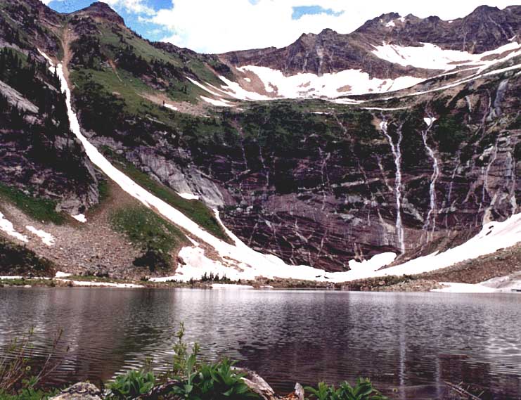
OKANAGAN LAKE, KALAMALKA LAKE
Includes: Communities of Vernon, Armstrong and Enderby, Boutique Shopping, Hotels, Heritage Features, O'Keefe Ranch, Agritourism Attractions, Wineries, Museums, Art Galleries and Performance Venues, Murals, Cheese Factory, Caravan Farm Theatre, Art Studios, First Nations.
Nature-based Bearfoot Routes:
ENDERBY CLIFFS TRAIL From Mabel Lake Road and Brash Allan Road in Enderby, the Enderby Cliffs Trail including the summit.
SHUSWAP RIVER From the upper Shuswap at Greenbush Lake to, and including Sugar Lake then to Mabel Lake, to Kingfisher then to Enderby.
MABEL LAKE
Includes: Communities of Vernon, Coldstream, Lumby, Cherryville, Boutique Shopping, Hotels, Heritage Features, Agritourism Attractions, Wineries, Museums, Art Galleries and Performance Venues, Murals, Art Studios.
Nature-based Bearfoot Routes:
GRAYSTOKES PLATEAU From Graystokes Road to the Graystokes Plateau Trail System to Buck Mtn. to Buck Hills Rd to the Aberdeen Plateau and including Ferry Lake.
UPPER GRANBY DRAINAGE From the Kettle River Forest Service Road to Winnifred Creek Road to Lightning Peak Route Trail at the north end of Granby Provincial Park
SHUSWAP RIVER From the upper Shuswap at Greenbush Lake to, and including Sugar Lake then to Mabel Lake, to Kingfisher then to Enderby..
CAMELS HUMP TRAIL From Creighton Valley Road and Cleir Lake Road to Camels Hump Trail and including the Camels Hump summit.
SAWTOOTH RANGE From Mabel Lake Rd and Taylor Creek Road to Park Mountain, then along the Sawtooth Range Ridge to Tsuius Mountain Trail to Tsuius Mountain, Mount Mabel and Joss Mountain including the drainage to Cottonwood Bay on Mabel Lake, and the Joss Mountain Trail down to Greenbush Lake.
RAINBOW FALLS TRAIL From Sugar Lake Road to the Rainbow Falls Trail to border of Monashee Provincial Park and including Rainbow Falls.
THE PINNACLES From North Fork Road in Cherryville to the Twin Lakes Trail including Twin Lakes, then to the Mark Berger Traverse to Monashee Lake which meets the Monashee Lake Trail ending at South Fork Road. From South Fork Road to the Pinnacles Lake Trail including Pinnacles Lake; and Vista Pas Trail and the Barnes Creek Trail which ends at Fife Creek Road which turns into Keefer Lake Road.
KALAMALKA LAKE, MABEL LAKE, SUGAR LAKE