ENDERBY CLIFFS TRAIL
From Mabel Lake Road and Brash Allan Road in Enderby, the Enderby Cliffs Trail including the summit.
SHUSWAP RIVER
From the upper Shuswap at Greenbush Lake to, and including Sugar Lake then to Mabel Lake, to Kingfisher then to Enderby.
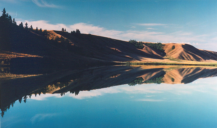
MABEL LAKE
SHUSWAP RIVER
From the upper Shuswap at Greenbush Lake to, and including Sugar Lake then to Mabel Lake, to Kingfisher then to Enderby..
SAWTOOTH RANGE
From Mabel Lake Rd and Taylor Creek Road to Park Mountain, then along the Sawtooth Range Ridge to Tsuius Mountain Trail to Tsuius Mountain, Mount Mabel and Joss Mountain including the drainage to Cottonwood Bay on Mabel Lake, and the Joss Mountain Trail down to Greenbush Lake.
RAINBOW FALLS TRAIL
From Sugar Lake Road to the Rainbow Falls Trail to border of Monashee Provincial Park and including Rainbow Falls.
Copyright - Bearfoot Canada
Adventure Okanagan Co-operative
3201 Pleasant Valley Road, Vernon,
British Columbia Canada V1T4L4
Bearfoot Canada Manager: Don Elzer
250-547-9812
Email: elzer@bcgrizzly.com
www.bearfootcanada.com
The Shuswap is situated in south-central British Columbia midway between Vancouver, BC and Calgary, Alberta. The Trans Canada Highway and Highway 97 make it easily accessible from all directions.
Falkland and Area is proud of its rural agricultural lifestyle and offers an abundance of small lakes and varied outdoor activities.
North Shuswap is a recreation and vacation paradise, with abundant sunshine and beautiful beaches. Tourism is the North Shuswap's main economic activity and the area offers numerous facilities and services to the ever expanding number of visitors.
Salmon Arm and Area is the economic and service center of the Shuswap. A pleasant climate and vast outdoor opportunities ensure an exciting stay in this area.
Sicamous and Eagle Valley is the 'houseboat capital' of Canada providing visitors with many options from water activities to hiking and snowmobiling in the winter months.
South Shuswap offers a relaxed lifestyle with a great variety of recreational choices and accommodation properties for the visitor.